A Whiteparish local history page from younsmere-frustfield.org.uk
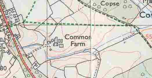
Common Farm dates from around 1830, built on land bought in 1793 by George Yalden Fort of Alderbury House [Matcham page 45]. George died in 1807 and his son, also George Yalden Fort, still owned the property in 1842, so the farm, estimated to have been built in about 1830, was presumably built by the son. It was renamed to Whiteparish Grange in the 1990s, first appearing as such on the 1995 Ordnance Survey maps.
The land that became Common Farm was one of five portions of Blaxwell manor [consider whether possibly two], divided by William Noyes between his five sisters on his death between 1622 and 1633 . In 1632 and 1657 a Mr Hayter purchased two of these parts, which were ultimately inherited by his grandson Thomas Hayter. Thomas then bought a third part. These passed from Thomas Hayter to his son William then to Miss Egerton. She married Francis-Thomas Hayter, who took his wife's surname Egerton and in 1793 sold the land to George Yalden Fort of Alderbury House, from whom it was inherited by his son, also George Yalden Fort.
[Add a diagram].jpg)
Whiteparish Grange on the 1995 OS map
The farm is shown exactly as on the map above, with the exception of the change of name
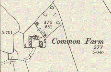
Common Farm was described by Christopher Taylor as being "built in the old assarts about 1830 (architecturally)". It was not shown on the map of 1811 and first appeared on the 1842 Tithe Map, with a garden behind it, owned by George Yalden Fort and farmed by Amelia Percy, who also rented the house and farm buildings. George owned "three fifths" of the old Blaxwell Manor, including Legges Farm (now Chalkpit Farm) and Hayter's Wood, these being the parts collected together by the Hayter family, as well as other land, mostly in Whelpley Manor. George H Fort is quoted as member of gentry at "The Common" in Kelly's Directory of 1889 [see here].
[Revise the Common Farm boundary on the map below to align with the holdings, or at least with the contiguous section of it.]
.jpg)
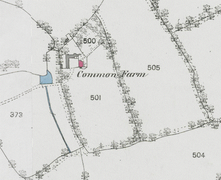
The land occupied by Amelia Percy in 1842 in pale blue on the Tithe Map
Christopher Taylor states, partially incorrectly [WAM Vol 62, 1967, page 100] that... "In the western half of the parish the Nelson family, who acquired most of the land there, also built a new farm, south of Blaxwell Farm in the old assarts, called Common Farm, about 1830 to judge from its architecture". Taylor's assessment of the date of construction is sound, but this was never part of the Nelson or Eyre estates. The map below, taken from Tithe Map owners shows the maximum extent of the Eyre estate in 1842 in pink; this became part of the Nelson estate when Thomas Bolton became Earl Nelson in 1835 although Frances Elizabeth (nee Eyre) continued to hold these lands until her death in 1878, when they passed into the Nelson esates held by her son Horatio, who became the third Earl Nelson when his father died in 1835 just six months after acquiring the title. Common Farm stands on the green land that was owned by George Yalden Fort at that time.
.jpg)
Common Farm in 1842 showing owners: pink Countess Nelson (Frances Elizabeth Eyre->Bolton->Nelson), green: George Yalden Fort
The 1807 first edition Ordnance Survey map below shows a blank area where Common Farm was later built. The layout of farm and access roads hasn't changed since and this early survey wrongly placed Blaxwell too far to the west; it should have been shown below the letters 'ri' of Parish, with the tracks between it and Romsey Road by the Parish Lantern and between it and Common Road exactly as they are today.
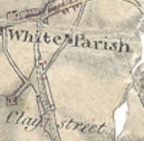
The first edition Ordnance Survey map of 1807 shows Blaxwell too far west (in the gap between the words White and Parish)
Common Farm didn't feature in the space to the south of it
The next set of four maps show Common Farm in 1842, 1876, 1900 and 1924. Remarkably little change took place to the buildings in that period of 117 years.

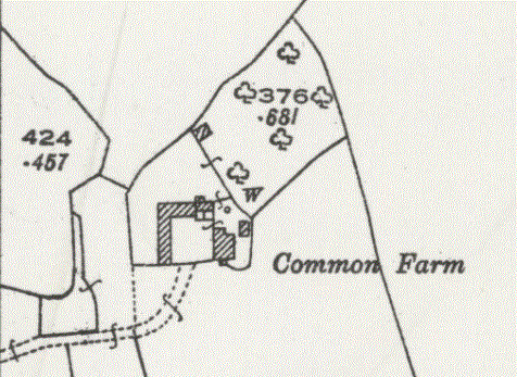
Common Farm in 1842, 1876, 1900 and 1924 (survey dates for the latter three)
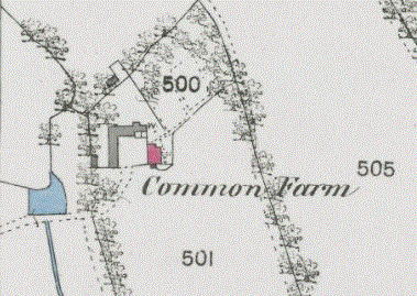
More building has taken place in recent times. A completely new farmyard was built to the east and the old farm buildings were demolished, leaving just the farmhouse. Before 2000 the farmhouse was replaced by a very large modern house and then a second similar house built on the other side of the access road from Common Road, both clearly visible from Common Road, and at about the same time the name was changed from Common Farm to Whiteparish Grange. Most of the newer farm buildings are in the field shown as 505 on the left hand (older) map below, with the northern of the two modern houses standing on the site of the old farm house (shown in red on the older map). These two maps are quite difficult to compare using just field boundaries, so parts of the two maps have been aligned below, divided across the old farmhouse, so that both the old (left) and new (right) farm buildings can be seen together in context.
 .
. .gif)
LEFT: The original buildings of Common Farm on a map dated between 1844 and 1888
RIGHT: A map of 2025 showing the same area and to the same scale
The map below indicates the alignment of these two maps
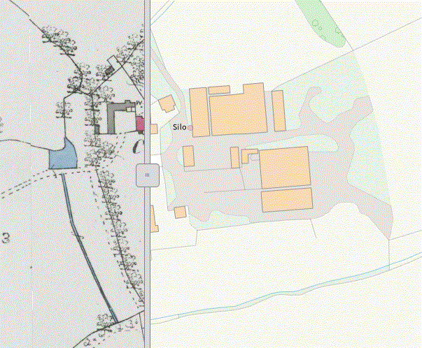
Parts of maps of 1844-1888 and 2025 aligned to show both the old and new farm buildings, the partial red building being the old farmhouse